San Quintin Beach
San Quintin Beach

Ensenada Mexico
to San Quintin
3/1/05
San Quintin Album
This leg takes me further south, to an area known as San Quintin. This is actually the villages of San Quintin and Lazaro Cardenas, which have run together along highway 1.
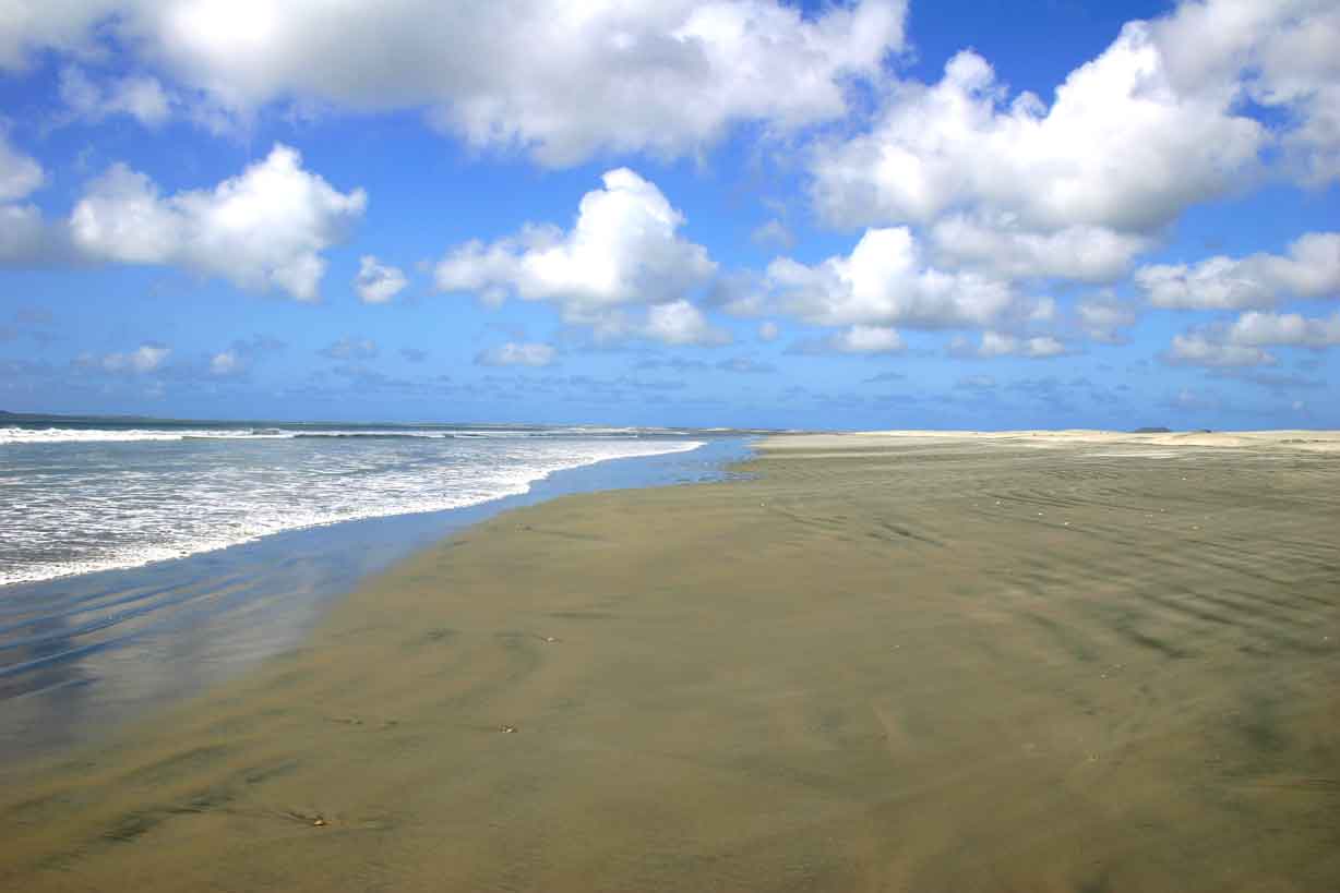
Here a large salt-water lagoon system fronts a fertile plain. All of this would have probably eroded away long ago except that there are eight small volcanoes (seven onshore and one an island offshore) that shelter the area from the sea. The area is heavily farmed, unfortunately, there isn’t a large enough fresh water aquifer and, due to the large drain on it by the agribusinesses, salt water has started to displace the fresh water. Consequently the farming efforts are slowly being forced east, on the other side of Hwy 1.
This area is also known for its goose & duck hunting and offshore fishing.
ROAD REPORT: Departed the Monalisa and headed south out of Estero Beach. At km 31 I ran across an army roadblock, but again they were only inspecting the northbound traffic. Directly after the roadblock I entered the hill country. They have some roads, turns and drop offs that rival anything you find on the Sonoma California Highway 1. The road itself is the usual 2-lane highway with 9.5 ft lanes and no shoulders.
This mountainous area is very scenic; it’s very green with the recent rains and the flowers are in bloom. The hillsides are covered with small bushes and trees. There aren’t any tall trees; about 15 ft is the norm. The colors are mostly yellows and whites with a few purples thrown it. The valleys are full of farms and ranches. There is a lot of grape and olive orchards and truck farms; very picturesque!
Spotted a new road sign; “No Tire Busara”. I have no idea what it means. I though Busara was trash.
The towns have added a new twist to the topes; they have about 10 small topes preceding the big tope, with the spacing between these small ones decreasing as you get closer to the main one. Talk about rattling your eyeteeth! It’s like driving across railroad ties at the end. In town, at any intersection of 2 paved roads, the mini-topes extend all the way across both lanes, not just the approaching lane, so you get your teeth rattled coming and going.
I’ve seen about 4 Northbound caravans so far, and no south bound ones. The smallest was 10 RV’s and the largest was 22 RV’s. I can see how they could overwhelm an area. I haven’t seen many single RV’s though; maybe 2 or 3.
The turnoff to Cielito Lindo Motel and RV Park at Km 11 is at the La Pinos packing plant. There is a sign for the La Pinta Motel but none for Cielito Lindo or Gypsy’s Beach Camp, which is past the Cielito Lindo. The road starts out paved but the first half block is through the Pinos packing plant and its all mini-topes, small but enough to rattle you. After that, the road is still paved and someone has filled in most of the potholes, but it’s still rough. The church’s book leads you to believe that it’s paved all the way to the park but it’s not. Once you pass the turn-in for La Pinta, the last 0.8 mile is a badly rutted and potholed dirt road. I found the smoothest route is on the far left for most of the way. Luckily, there wasn’t any oncoming traffic.
Church’s guide also shows what may look like a short cut to Cielito Lindo in the way of a paved road labeled “ Old Highway”. Unless you’re driving a 4WD with high clearance, DON’T take this road. About a quarter mile of it, in the middle where there’s no place to turn around, has reverted to dirt and sand. This stretch is very badly potholed and rutted and the sand section is extremely soft. I drove this road in my toad, on my way back into town, and was dragging the undercarriage in places. In the sandy area I almost got stuck. The only thing that saved me was the front wheel drive. I would have been a cooked goose in the Coach. Stick with the main highway.
I also took a run out to the Old Mill RV Park and Fish Camp. This was where I originally planned to stay, but changed my mind when I saw what the recent rains had done to the dirt roads in Ensenada. The Old Mill is at the end of a 3 mile stretch of dirt road that was considered bad BEFORE the rains. The foray in the toad proved that my decision was correct. This road is totally flooded in about 3 sections and washed out in a couple of others. The traffic has started driving through the fields to get around these bad spots. There is evidence that some repairs have been started but not much improvement has been made. There wasn’t any work going on when I drove it on a Thursday morning.
RV PARK REPORT: Cielito Lindo Motel and RV Park. No known website. E-mail www.cielitolindo@bajasi,com: $8/night.
This park is primarily a motel and restaurant with about 8 back-in RV sites and some tent camping sites. The RV sites are large enough for the biggest coaches and there is a large turn-around area in front of them. They have water, sewer, and 15 amp electricity hook-ups; however the electricity is an on-site generator that is run from about 2 PM to 10/11 (or when they shut down the bar) and for a while in the morning (7 to 11 or 12). It also has a lot of full-time residents in a separate section that is a combination of RV sites and cottages. There is a stable that advertises “horses for rent” but, at this time of the year, the only residents were 2 small burros, a mule, and a goat. The restaurant is famous for its crab dinners and other foods. Unfortunately they didn’t have any crab when I was there, maybe on the return trip.
This park is about 1/4 mile from the beach across coastal scrubland. The Gypsy’s Beach Camp is farther down the road and directly on the beach. However, since they are strictly a dry camp I opted for the comfort of full hook-ups. I did have lunch at the Wet Buzzard there; they have excellent beef & bean burritos and are also known for their breakfast burrito.
The Old Mill Trailer Park (no known website or e-mail) looks like a nice place with a well-respected restaurant, a good boat launch and charters available. The RV sites are concrete pads with water and power but no sewer (Church’s guide says there are sewer connections but I didn’t see any). However, I wouldn’t attempt the road with a class A of any size right now. I might stop on my return trip.
WEATHER REPORT: The first full day was extremely windy, overcast, and cold, about 55 degrees F. The next two days were cool and breezy but much better.
Well, I finally decided to check on my voice mail so I drove back to the Pemex station where there is a pay phone. It accepts the local calling cards, so I purchased one for 100 Pesos and gave it a try. I planned on using the local phone card to call the Escapee’s Mexican phone card number and then use the Escapee’s to make the long distance calls. Even with instructions in Spanish and English written on the phone, I still had a little time figuring it out. First, you pick up the receiver and you get a dial tone. Then you have to insert the card and leave it in until you’re done. You still have the same dial tone. Then when you start pushing numbers the dial tone stays on but the numbers show up in the LCD window. After you’ve dialed about 3 or 4 digits, the dial tone goes away and you hear the numbers being dialed. This is kind of disconcerting because you haven’t completed entering the number yet. Nevertheless, you can just keep on dialing and if it catches up with you, it’ll wait until you’re done. I hung up a couple of times before I figured that out. The best way is to ignore what you’re hearing and concentrate on the LCD message window.
After all that, I finally got through and checked my messages. There were two (the little light on my cell wasn’t lying to me after all), both from the Phoenix Tricare wanting to sign me up for some kind of health management program. I think I’m doing a pretty good job managing my health so I’ll contact them when I get back.
Well, I’ve eaten up all my beef, citrus fruit, and most of my veggies, so I’m ready for the inspection station going into Baja Sur. I’ll be pulling out in the morning for Guerrero Negro. It is on the other side of what is called the “gas gap”, about 193 miles with no gas stations. There is a turn-off about half way that goes to Bahia de Los Angeles (commonly called LA Bay) on the Gulf of California; but I’m in a hurry to get into some warmer weather so I’ll postpone that side trip until I’m coming back.
GOODBY BAJA CALIFORNIA, ON TO BAJA SUR