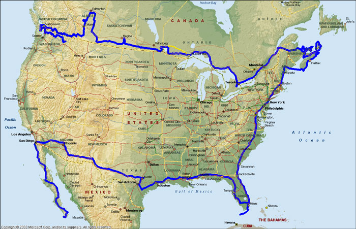
PROJECTED ROUTE
| |
The blue line is a projected route for the time period of March 2004 to March 2005. My intent is to spend the summer crossing Canada, from Victoria, BC to Halifax, NS. I expect to reach the Maritime Provences by early September and, as long as the weather stays warm, tour the area. I'm planning on stopping at as many nudist resorts as possible. Then I'll head down the eastern seaboard of the U.S, stopping at various "singles friendly" nudist resorts. By the time the weather starts to cool I should be in the southern states, ending up in Key West.
After that, it's across the bottom of the U.S. I plan on spending the month of November at DeAnza Nudist Resort in Jacumba, California, January & February at Shangri-La nudist resort in Phoenix Arizona with side trips to Sedona, Quartzsite and Needles. Finally I end up in Cabo San Lucas for the month of March.
If you'd like you can compare this map with my "Trip to Date" map and see how close I've stuck to this projection. I have a feeling that there well be numerous changes. If the weather turns bad on me I'll have to curtail my trip and head for my winter camps, picking up where I left off next spring.